
Roads Management Insights from Google
My take on Google Maps Road Management Insights, and how you can use Google's traffic data to analyze real time and historical traffic patterns.

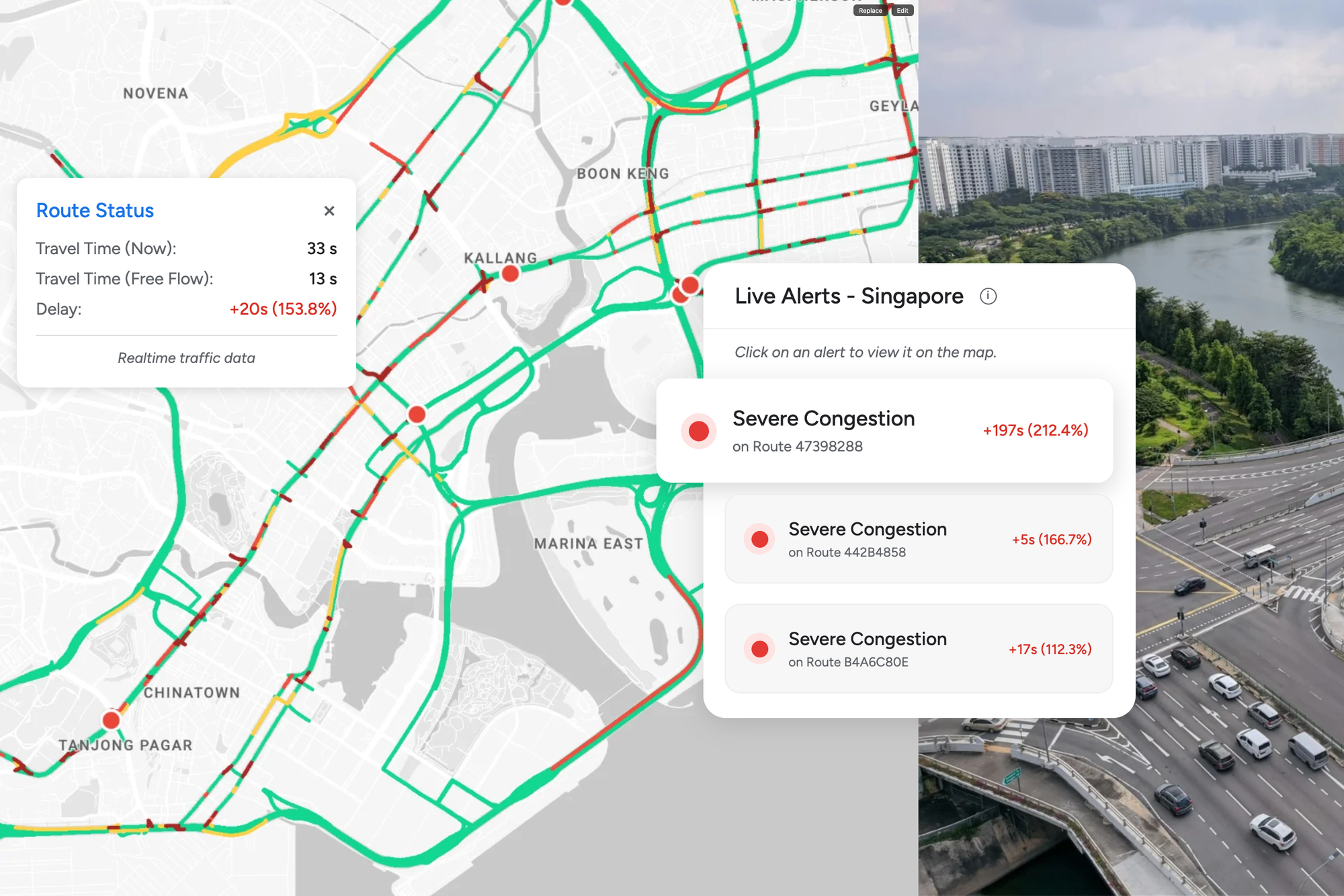
Roads Management Insights (RMI) is a brand new product from Google that lets you pull historical and real time traffic data from Google Maps that you can use for live monitoring, traffic pattern analysis, or machine learning and AI model training. Its targeted at state and city transportation departments, highway agencies, urban planning departments and the consultancies and engineering system integrators that serve them.



What is Google Roads Management Insights?
Road Management Insights is a geospatial analytics tool that gives you congestion data for whatever roads you care about. You can get it as regular snapshots for long term analysis, or as a near realtime stream to keep tabs on what's happening right now. I'm excited about RMI for three reasons.
First, Google has relaxed the terms of service for RMI. Unlike most Google Maps APIs which strictly forbid using Google's data to build derivative products, RMI lets you cache Google Maps traffic data and feed it into statistical or machine learning models.
Second, Roads Management Insights delivers its data as BigQuery datasets you can work with directly. That means you can run reporting, dashboards, and analysis without provisioning or managing any infrastructure. This marks a big shift for Google Maps away from transactional APIs to analytics native delivery.
Third, it productizes data Google already has but never exposed. Google Maps has always sat on an enormous, continuously refreshed corpus of real world traffic behavior. Road Management Insights turns that unused asset into a structured, licensable analytics product that Google Maps Partners like me can sell.
Where does data from Road Management Insights come from?
Everyone using Google Maps or Waze on an Android phone with Google Play Services enabled is sharing their data with Google (knowingly or not). From that data, Google derives each device's location, speed (by measuring the timing difference between consecutive location pings), and heading, then aggregates it all to estimate how fast traffic is moving on a given road segment. And because so many people run Google Maps or Waze, the resulting picture is remarkably accurate.
Road Management Insights uses cases
There are two fundamental use cases for Road Management Insights. Real time monitoring and longitudinal traffic analysis.
Real time monitoring
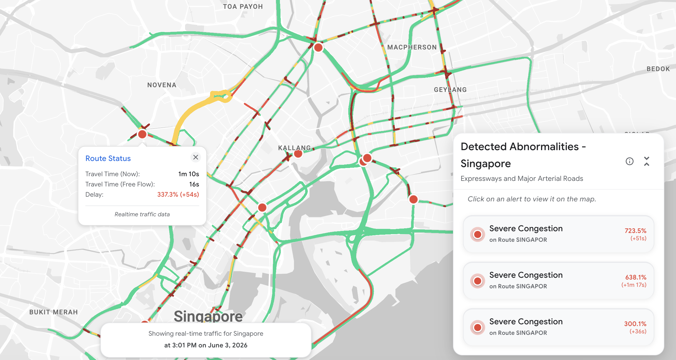
Most of us take smooth flowing traffic for granted. But in every major city, a department of transportation is monitoring the road network in real time, around the clock. These Traffic Management Centers (TMCs) detect and verify incidents, dispatch incident response crews to clear blockages, and push travel advisories out to the public. For decades, that monitoring has run on physical infrastructure such as inductive loop detectors counting vehicles and video cameras trained on key intersections and corridors. It's a vast, largely invisible surveillance apparatus that is expensive to install, maintain, and expand. All this to answer a deceptively simple question. Is traffic moving the way it should, and if not, where and why?
Road Management Insights gives these centers a zero hardware alternative to physical surveillance infrastructure. Traffic speed and flow are computed from the aggregate driving behavior of Google Maps users, and current conditions can be compared against a historical baseline to flag congestion that's unexpected, which would suggest that an incident rather than ordinary rush hour traffic may be to blame.
Longitudinal traffic analysis
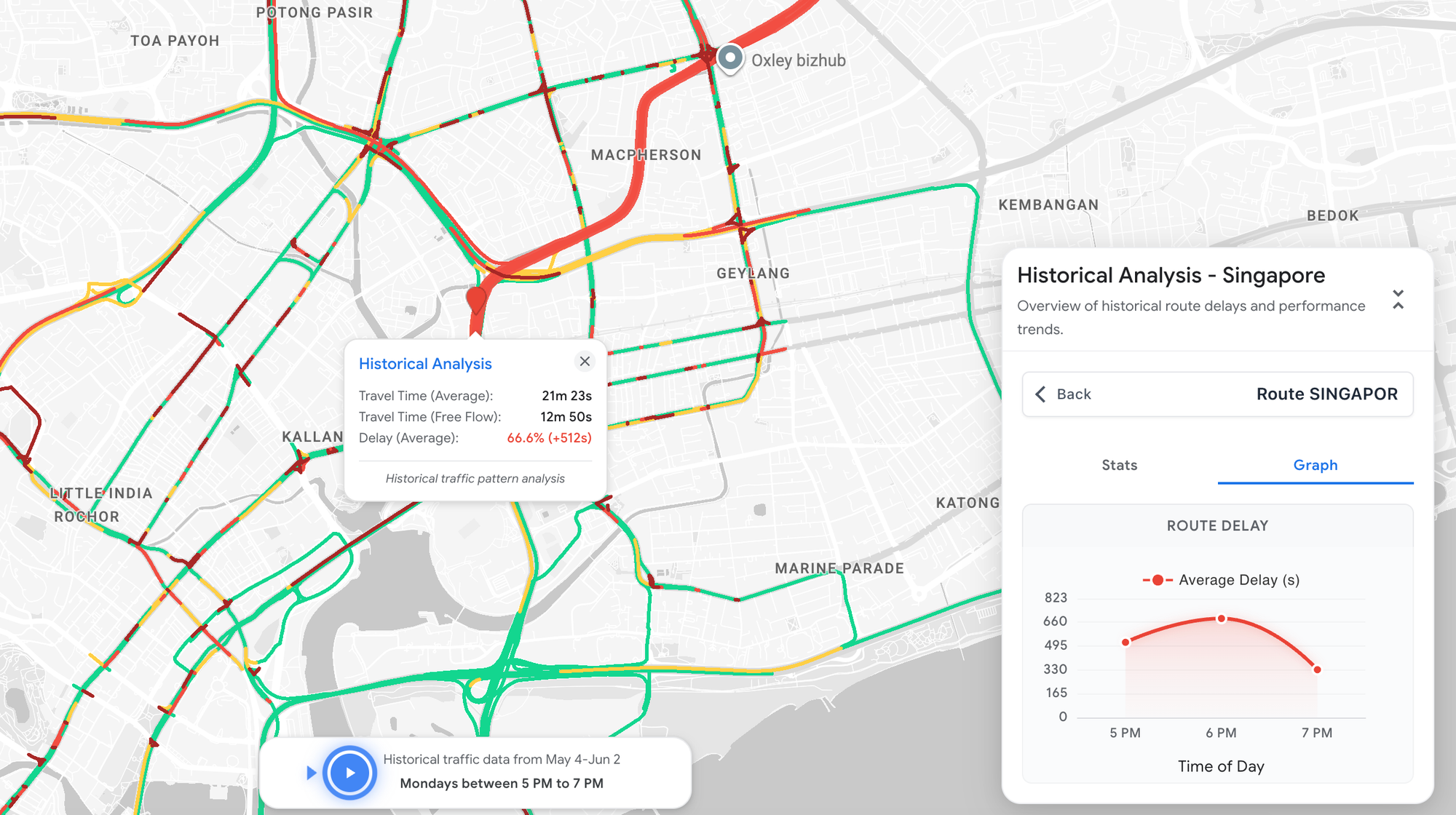
Beyond managing real time disruptions, TMCs also review traffic data to identify recurring bottlenecks, evaluate interventions like traffic signal timing and congestion pricing, and inform longer term planning. To do this, they need to compare current traffic speeds against historical baselines (not just "is the road slow right now," but "is it slower than it normally is at this hour, on this day, in these conditions?"), which is exactly the kind of data that Road Management Insights provides.
Because it's computed from the aggregate driving behavior of Google Maps users and delivered as historical collections alongside near real time streams, agencies get both the long run baseline and the live signal, without having to build and maintain the surveillance and storage infrastructure themselves. They can also rewind and replay past traffic, watching how conditions unfolded on any earlier day.
How does Road Management Insights from Google work?
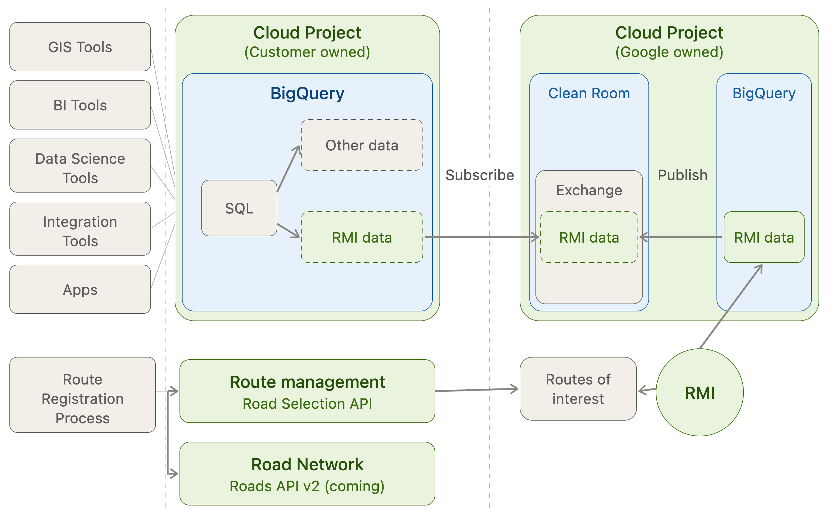
Unlike standard Google Maps Platform APIs which return data in response to individual API calls, Road Management Insights uses BigQuery clean rooms to securely share the traffic data you subscribe to directly with your own BigQuery instance. Here's how it works:
- Select your routes. Use the Roads Selection API to specify the routes you care about, each defined by an origin and destination. With enough origin - destination pairs, you can cover an entire neighborhood or city.
- Google publishes the data. Google refreshes the requested traffic data every one to two minutes and publishes it to a BigQuery clean room it owns.
- Your instance subscribes. Your BigQuery instance subscribes to that clean room, which populates your own instance with the data. From there, you can use standard BigQuery tooling to analyze it however you need.
What data does Road Management Insights provide?
As of 2026, Road Management Insights provides three main types of data:
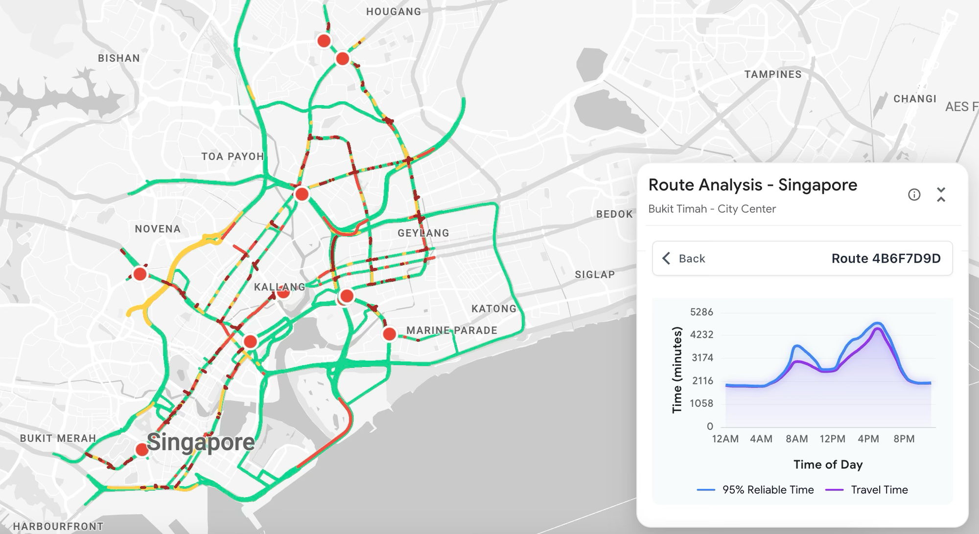
Trip durations, the calculated travel time for a route, in two forms: traffic aware duration (accounts for congestions) and static duration (the traffic unaware baseline).
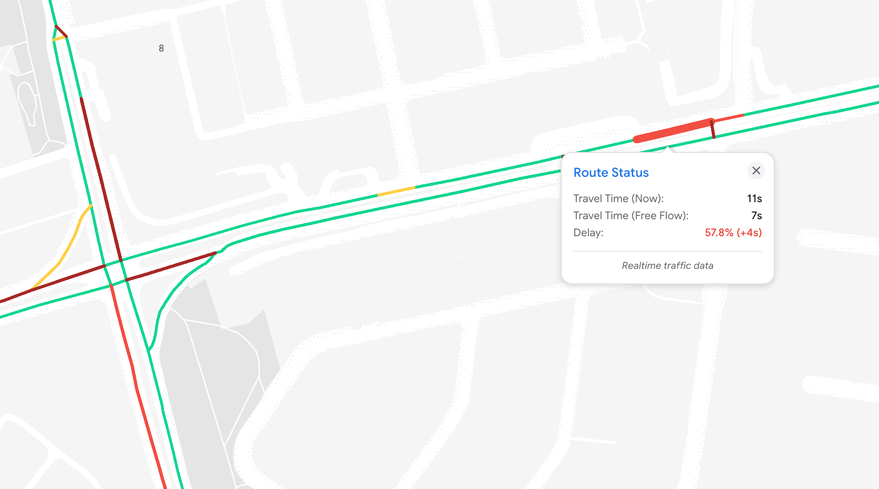
Speed reading intervals, the segment level traffic density indicator that shows whether vehicles are moving at normal speed, in a medium slowdown, or facing considerable delay (similar to how traffic aware polylines work on the Routes API).
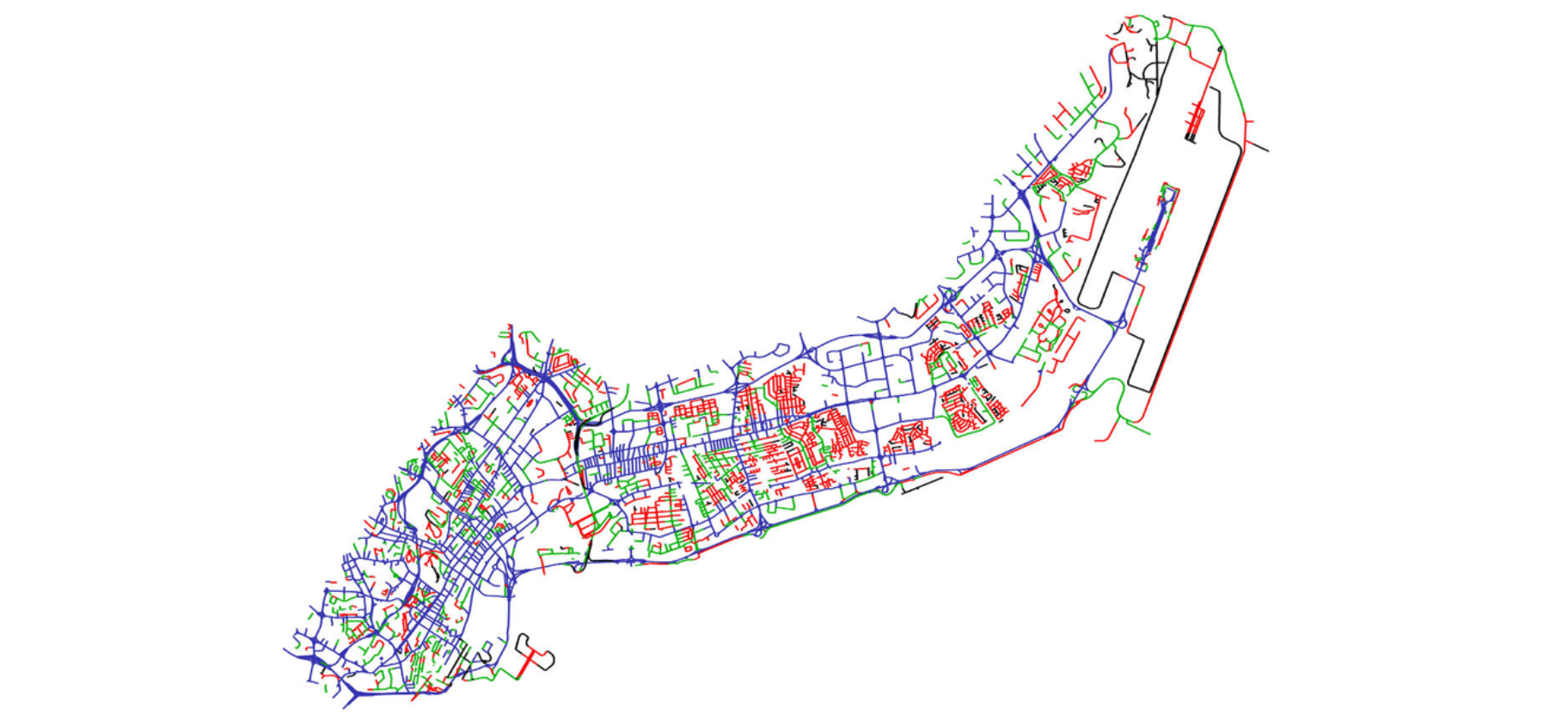
Road network data that gives you the geometry of each selected route or the entire road network.
For the second half of 2026, Google's product roadmap for RMI also includes:
- Hard braking events and evasive maneuvers, flagged whenever a phone's accelerometer detects the vehicle decelerating faster than 3 m/s². Clusters of these events highlight dangerous intersections where drivers are repeatedly slamming on the brakes (see Hard-braking events as indicators of road segment crash risk).
- Vehicle counts, estimated counts that show how much traffic volume a given road segment carries. This opens up new use cases, such as attribution for billboards and roadside advertising.
- Disruption reports listing crashes, objects on the road, and stalled vehicles reported by Google Maps and Waze users.
Road Management Insights pricing
Road Management Insights is sold through the Google Maps Partner network on an annual license, which can run anywhere from USD $150k to $1.5M depending on the size of your road network, how often the data refreshes, and whether you need real time data, historical data, or both. On top of the license, you'll also pay a recurring monthly cost to run your Google Cloud project and BigQuery.
From what I've seen, licenses are sold under three kinds of contracts:
- License only. You buy the RMI license and your own engineering team does the integration and Google Cloud infrastructure setup to receive and store the traffic data RMI generates.
- License plus services. You buy the RMI license along with a services contract from the Google Maps Partner, who sets up RMI on your Cloud infrastructure and builds basic dashboards and scripts to pull the data into a format your organization can use. Google can and often does co-fund part of this development cost.
- Third party wrapper. You access RMI through a product like TraffiCure or TraceMarkFlow. These come with out of the box dashboards and map based visualizations, so the data is usable immediately.
In all three cases, expect about 4 - 6 weeks to go from license start to full production use, longer if you need custom development. It takes time to configure your routes correctly through the Roads Selection API, and you need at least a few weeks of data to establish baseline congestion levels before you can meaningfully flag slower than normal traffic.
My take on Road Management Insights from Google
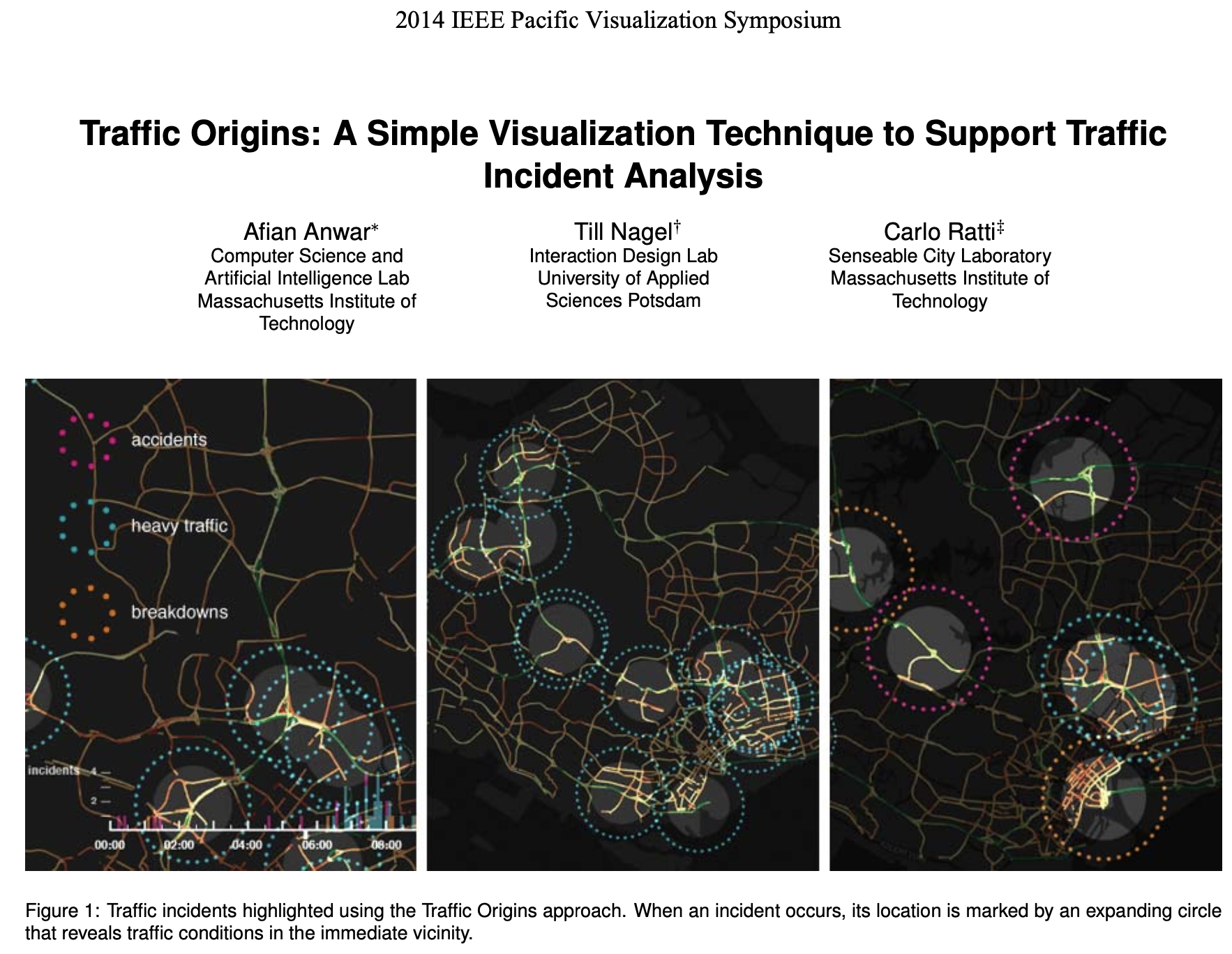
Before I was a Google Maps Partner, I was a graduate student at the MIT Computer Science and Artificial Intelligence Lab, working on large scale traffic optimization problems (one of earliest published papers was Traffic Origins: A Simple Visualization Technique to Support Traffic Incident Analysis). The hardest part of the work was data collection. Google Maps had just started getting popular, but there was no easy way to get traffic data out of it, so we used loop detector data to estimate traffic flow and build realistic simulation models. It was enormously time consuming and not very accurate. Loop detector coverage is sparse even in infrastructure rich cities like Singapore, and it isn't representative of overall traffic the way Google Maps is. A product like Road Management Insights would have saved me months of work.
But demand for a product doesn't guarantee it will be a commercial success. RMI deal sizes are large, yet the public sector organizations it targets e.g. local transportation authorities and the like take a long time to sell to. Public sector procurement can be brutal. Sales cycles are measured in years, not months, and software sales often pass through several layers of accredited consultants and system integrators, adding cost and complexity to what should be a simple licensing deal.
Selling analytics products to transportation agencies isn't a walk in the park either. One of Afi Labs' first products was BusViz, a big data analytics platform for bus fleets. As a small company, it was hard enough to sell to governments in the first place. But you also end up competing with your customer's own in-house engineering team, who are keen to pick your brain and use your industry knowledge and design expertise to build their own dashboards. They already own the data (and lots of it) anyway. What they lack is a way to visualize it in a genuinely useful way.
RMI may be new, but the idea of using real time traffic data to improve Traffic Management Center operations isn't. Many of the better funded agencies already get live traffic information from loop detectors, surveillance cameras, and competing vendors like INRIX and PTV Group. Asking them to replace decades of monitoring infrastructure investment for a software product is a big ask. Google could try targeting smaller operators that don't have much traffic-monitoring tooling, but in my experience it isn't worth it. The sales cycle is just as long for half the money, or less.
The biggest limitation, though, is the sales channel itself. Because RMI can only be sold through the Google Maps Partner network, Google depends entirely on the relationships and sales efforts of those partners, and very few of them have the experience or connections to sell effectively into the public sector. So why would they prioritize RMI when they can far more easily sell vanilla Google Maps APIs to their regular customer base of mobility, rideshare, and logistics companies?
This article was written by Afi Labs, a Google Maps Premier Partner and reseller. We build route optimization, navigation, and fleet tracking software on Google Maps, and offer volume pricing on GMP licensing. Talk to an engineer or follow Afian on LinkedIn.