
The complete Google Street View API guide
A practical guide to the Google Street View API including example code, pricing, best practices and use cases.


In this tutorial series, I'll tell you everything I know about Google Street View and how you can use it to bring real world imagery into your apps. I'll cover pricing, use cases and include code samples that you can use to ground your applications in real world context.

Part 1: The complete Google Street View API guide (this article)
Part 2: Add a street view image to your app with the Google Street View Static API
Part 3: Add interactive panoramas to your app using Dynamic Street View
Part 4: Use Google Street View for free by calling the Google Maps embed API
Part 5: Google Street View Insights: Analyze Google Street View images at scale




How did Google Street View start?
Google Street View began as a side project by then Google CEO Larry Page in 2001. Page handed the Stanford Graphics Lab a videotape he’d shot while driving around the Bay Area and challenged the lab to find a way to summarize it in a handful of images. The resulting research effort, the Stanford CityBlock Project led by Marc Levoy, photographed streets with a side facing camera on a moving vehicle and stitched the images into long, continuous panoramas of each block’s building facades. The project ended in June 2006, and its technology was folded into Street View with several of Levoy’s students joining the Street View team.
Today, most Street View imagery is still captured by Google’s ubiquitous Street View cars, each fitted with a roof mounted 360 degree camera. Places that cars can’t reach are filled in by the wearable Trekker backpack, boats, snowmobiles and 360 degree photos from community contributors.
Google (and Stanford) weren't the first to think of photographing streets and stitching them into a navigable view. Some 30 years earlier, DARPA funded MIT to build the Aspen Movie Map, an interactive system that let users virtually drive through Aspen, Colorado. The goal was to familiarize soldiers with unfamiliar locations before they arrived. What set Google apart wasn’t the idea but the execution. Street View improved on existing street level imagery platforms, thanks to its tight integration with Google Maps and the ability for developers to embed the images in their own products and services through various APIs. These Street View APIs are the focus of this tutorial series.
What is Google Street View?
Google Street View is a feature of Google Maps and Google Earth that lets you see and virtually explore places through street level, 360 degree panoramic photos. You drop into a location, look around in any direction, and “walk” along the street as if you were standing there. For developers, the same imagery is available through several Google Maps Platform APIs:
- The Street View Static API for images,
- The Maps JavaScript API and mobile SDKs for interactive panoramas (billed as Dynamic Street View),
- The Maps Embed API, which lets you easily place an interactive map or Street View panorama on your web page with a single line of code,
- Street View Tiles in the Map Tiles API and,
- Street View Insights for analyzing imagery in BigQuery.
Google Street View use cases
The Street View APIs are used wherever seeing a place virtually saves time or money, or is simply fun.
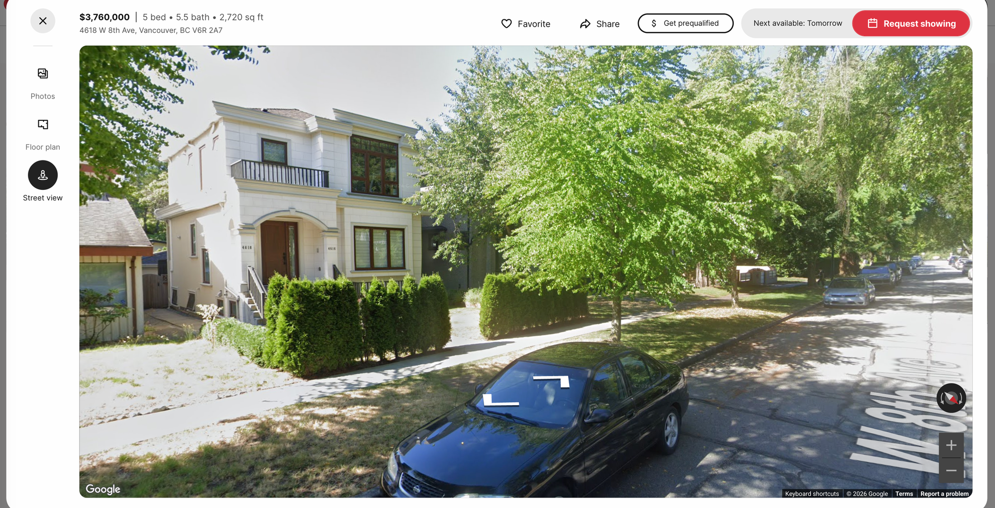
Real estate. If you've ever tried to buy a home online, you'd know how useful street view is. Real estate portals such as Redfin or Trulia show the street level view of a home and its neighborhood alongside photos and a map, so buyers and renters can check the surroundings without visiting.
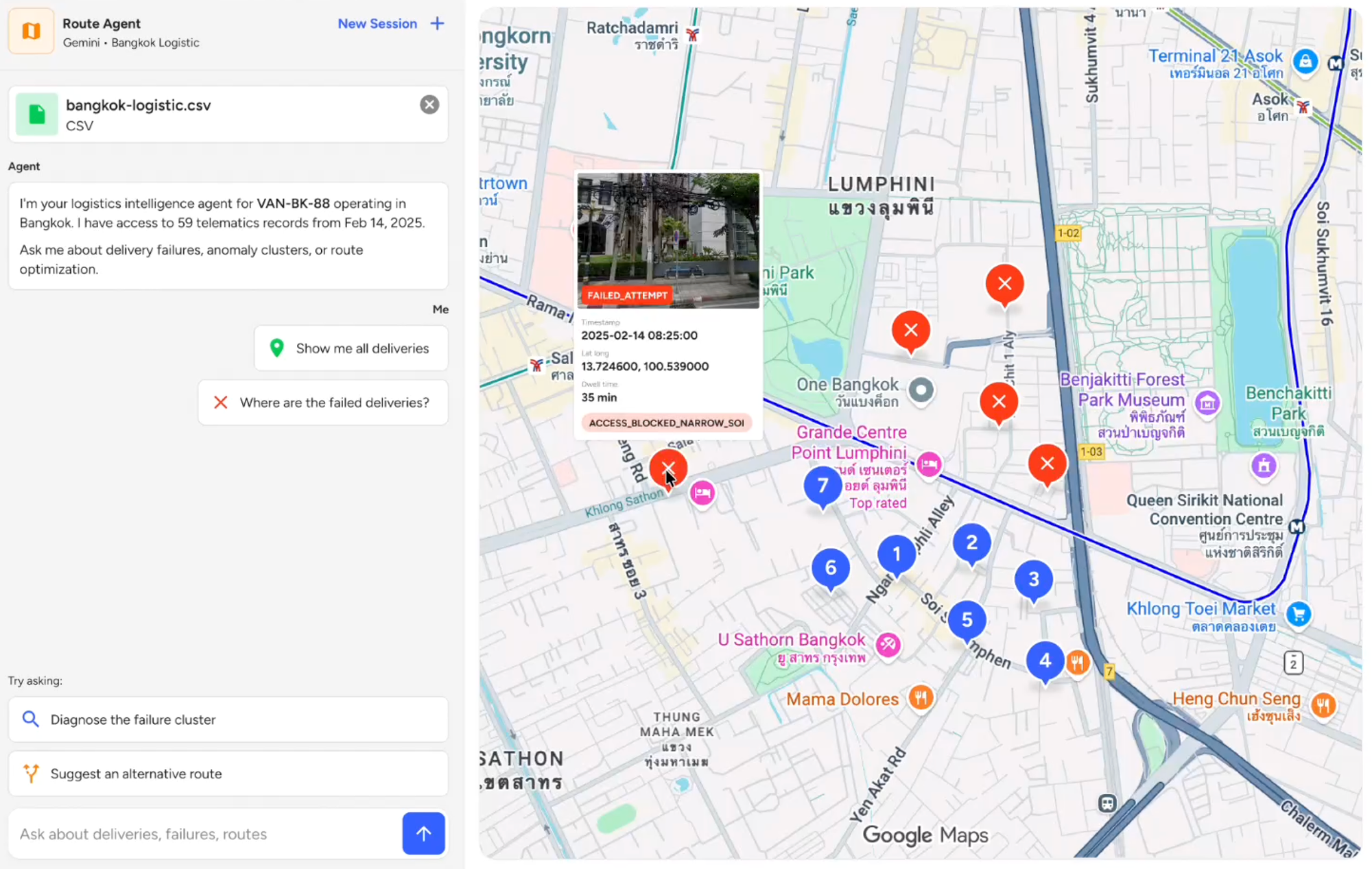
Logistics and last mile delivery. Delivery and field service companies use Street View to show drivers their destination before they arrive. In many parts of the world, and especially in Asia, wrong entrances, poor parking and narrow streets are a major source of delays and failed deliveries. A quick street level preview helps drivers find the right building and entrance, and lets dispatch teams check addresses and flag access issues before a route is even assigned.
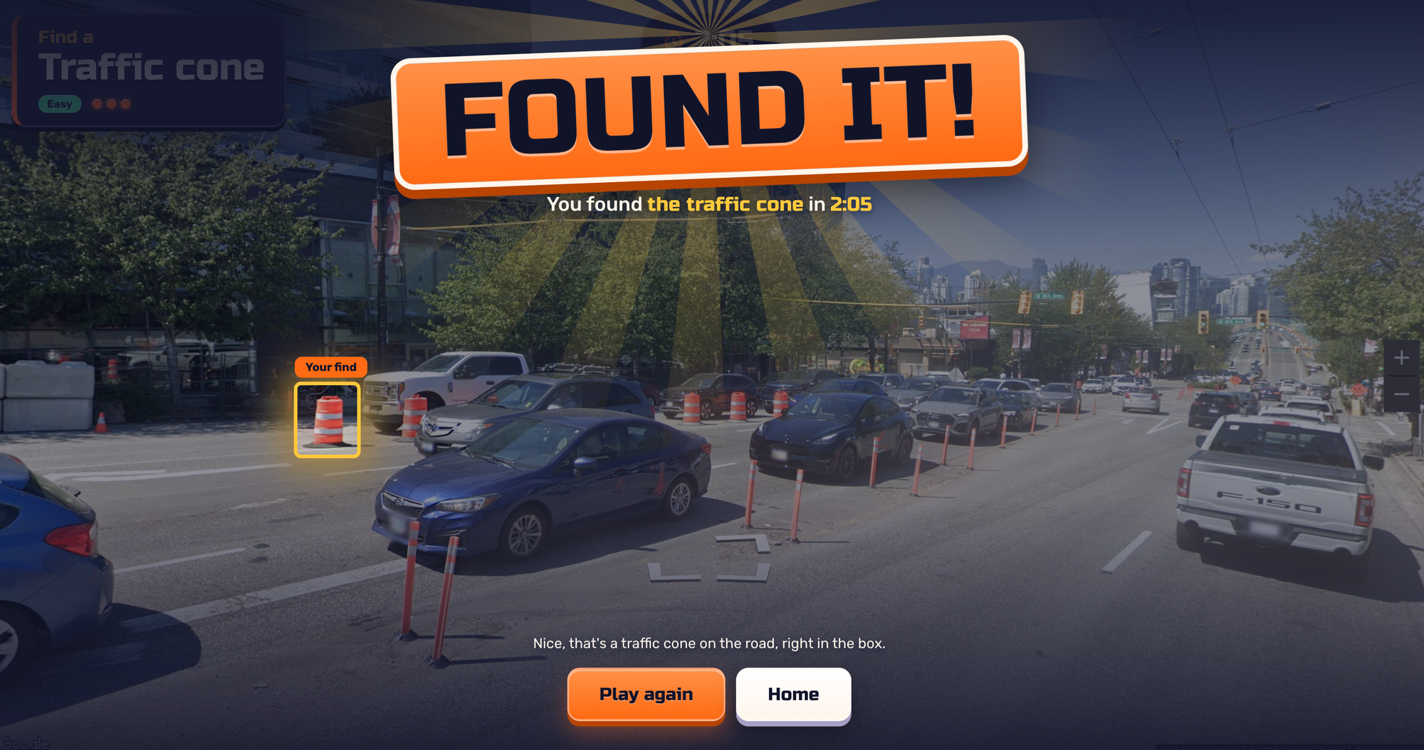
Games and education. GeoGuessr is the best known example. Players are dropped into a random Street View location and have to guess where in the world they are. Newer games put their own spin on the idea. In GeoBlitz, players race to spot a target object (such as a traffic cone) in Street View before time runs out, and AI checks whether they’ve found the right thing.
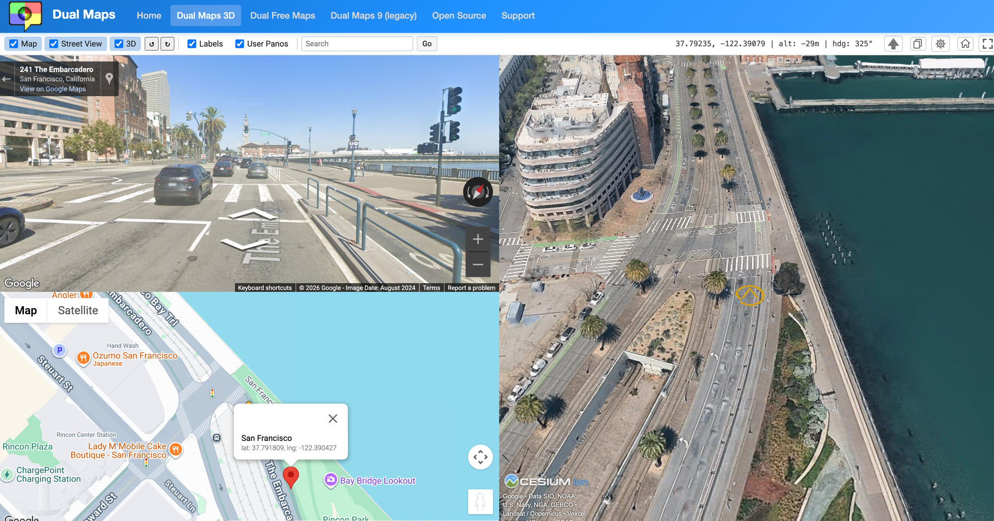
Virtual exploration and armchair travel. Some apps let people wander the world from their browser just for fun. Dual Maps is a long running example. Created in 2008, its latest version places a road map, street view and a photorealistic 3D view side by side, all synchronized to the same location. It even has a driver mode: you point Street View in the direction you want to travel and watch an animated journey unfold
How to see street view on Google Maps?
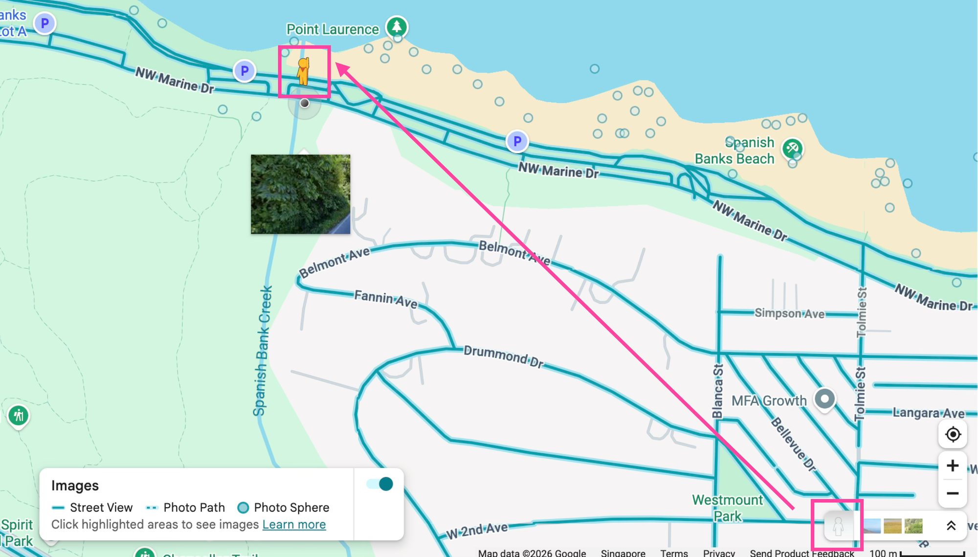
The easiest way to see street view in action is to open Google Maps and drag the yellow person icon (known as Pegman) from the bottom-right corner onto the map. As you drag, blue lines appear on roads that have Street View imagery, and blue dots mark individual 360-degree photos. Drop Pegman on any blue line or dot to jump into a Street View panorama you can rotate, zoom and move through.
How often does Google update street view?
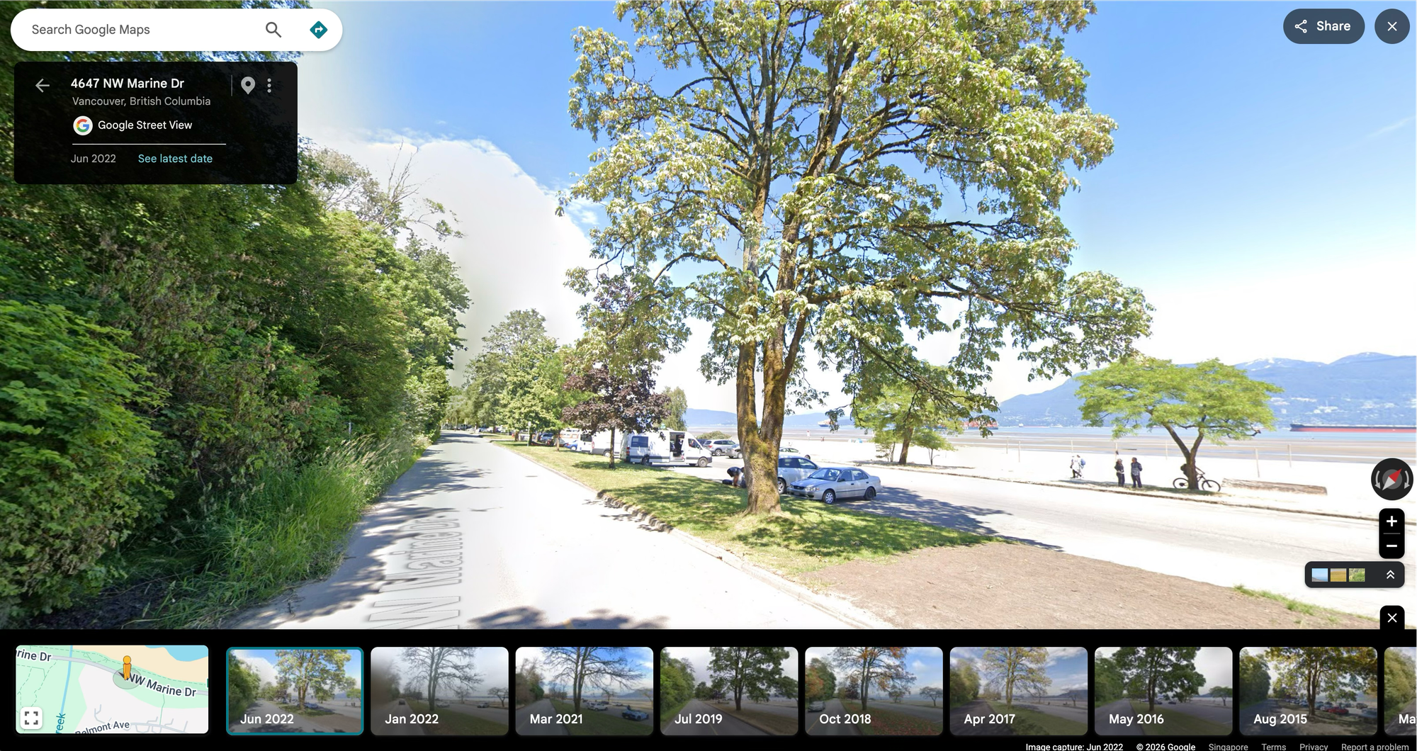
Google refreshes its street view imagery every 3 - 5 years. More frequently on busy roads in in big cities and less frequently in suburban areas and the countryside. To check how current imagery is, look at the capture date shown in the corner of any Street View panorama. You can also see previous street view photos and the dates they were published. Both the static and dynamic Street View APIs also return the capture date (year and month) for any location when using the /metadata endpoint (below).
Endpoint: GET
https://maps.googleapis.com/maps/api/streetview/metadata?location=49.276317%2C-123.217173&
key={GOOGLE_MAPS_API_KEY}
Response
{
    "copyright": "© 2026 Google",
    "date": "2019-06",
    "location": {
        "lat": 40.457355990552,
        "lng": -80.00935300121023
    },
    "pano_id": "2rCSt4wHHgAflhh2WksSeA",
    "status": "OK"
}
Does Apple Maps have street view?
Apple Maps has a Street View competitor called Look Around, but coverage is much smaller (mostly North America, Japan as well as parts of Europe, Australia and New Zealand) and it doesn't have a robust developer API like Google Maps does.
Google Street View API pricing
Like other Google Maps Platform APIs, most of the Street View APIs follows a pay-as-you-go pricing model, with volume discounts that lower the cost as your usage increases.
| Free Usage Cap | Cap - 100k | 100k - 500k | 500k - 1M | 1M - 5M | 5M+ | |
|---|---|---|---|---|---|---|
| Street View (Static) | First 10k | $7.00 | $5.60 | $4.20 | $2.10 | $0.53 |
| Street View (Dynamic) | First 5k | $14.00 | $11.20 | $8.40 | $4.20 | $1.05 |
| Maps Embed | FREE | FREE | FREE | FREE | FREE | FREE |
| Free Usage Cap | Cap - 1M | 1M - 5M | 5M - 10M | 10M - 50M | 50M+ | |
|---|---|---|---|---|---|---|
| Street View Tiles | First 100k | $2.00 | $1.60 | $1.20 | $0.60 | $0.20 |
Pricing for Street View Insights is not published and is quoted based on your use case and coverage needs. If you’d like a pricing estimate or a demo, please get in touch.
Adding Google Street View to your website
The easiest way to add street view to your website is to add a Google Map with streetViewControl: true. In React, you would add a <Map/> component from the react-google-maps library with the streetViewControl prop, which adds the Pegman control so users can drag it onto the map to enter Street View.
import { APIProvider, Map } from '@vis.gl/react-google-maps';

export default function StreetViewMap() {
  return (
    <APIProvider apiKey={import.meta.env.VITE_GOOGLE_MAPS_API_KEY}>
      <Map
        style={{ width: '100%', height: '100vh' }}
        defaultCenter={{ lat: 40.7295, lng: -73.9965 }}
        defaultZoom={15}
        streetViewControl
      />
    </APIProvider>
  );
}
What this blog post series will teach you
By the end of this tutorial series, you'll learn how to:
- Choose the correct Street View API. The Maps Embed API for a free iframe that needs no code, the Street View Static API for a single image in an email or the Maps JavaScript Dynamic Street View for interactive views.
- Point the camera at what you actually want to show, such as a building’s entrance rather than the road or sidewalk in front of it.
- Understand which use cases Google’s terms or service allow and which they don’t, such as scraping Street View imagery to train machine learning models or build your own datasets.
This article was written by Afi Labs, a Google Maps Premier Partner and reseller. We build route optimization, navigation, and fleet tracking software on Google Maps, and offer volume pricing on GMP licensing. Talk to an engineer or follow Afian on LinkedIn.
Next: Part 2: Add a street view image to your app with the Google Street View Static API